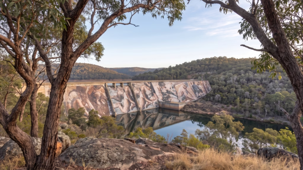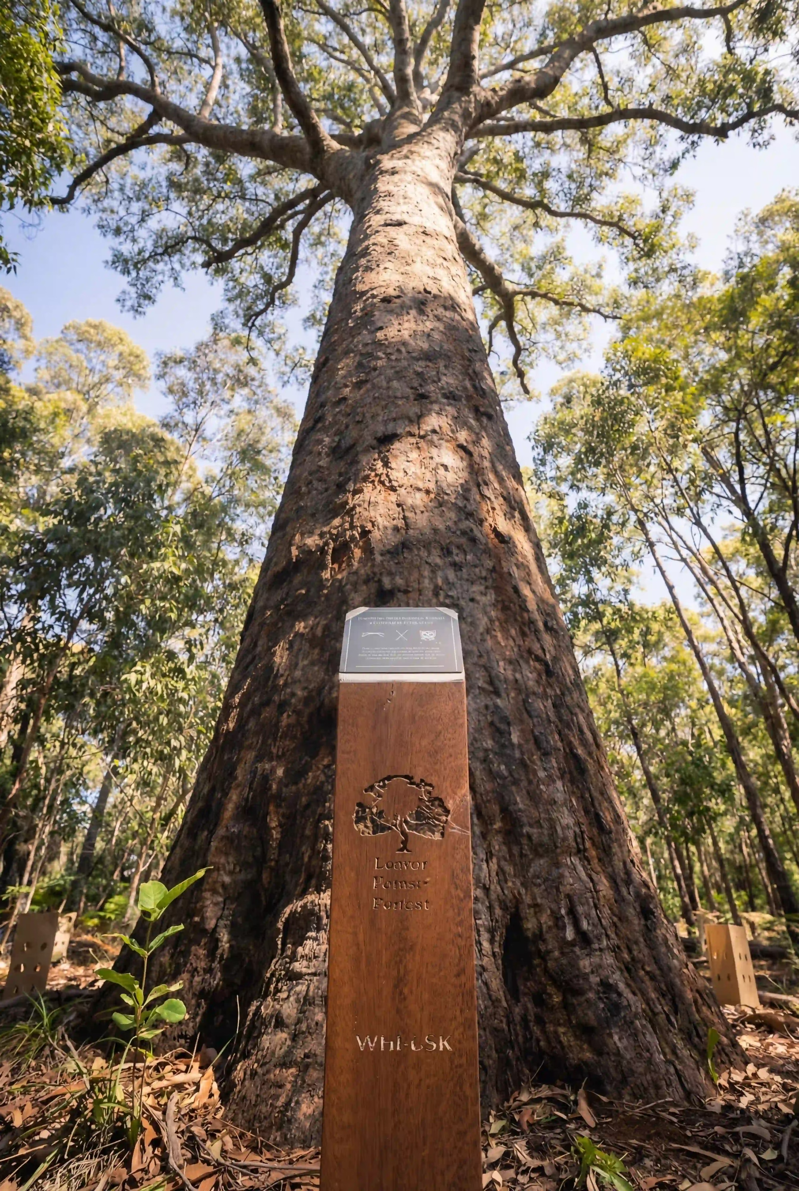

Wellington National Park is 25,000 hectares of jarrah, marri and blackbutt forest wrapped around the lower Collie River valley, about 7 kilometres west of Collie on the western edge of the Darling Plateau.
The valley is deeply cut, which gives it a cooler and damper microclimate than the plateau above it. That one difference decides most of what follows.
The park in numbers
| 25,000 ha total area after a 7,000 hectare expansion in 2021 | 273,000 visitors a year |
| 80% of the annual rain falls between May and October | 15 to 20% rainfall decline since the mid 1970s |
| 10 threatened and priority animal species recorded here | 4 eucalypts families can plant: jarrah, marri, blackbutt, bullich |
Park area and visitor numbers: DBCA. Rainfall seasonality and decline: Australia State of the Environment 2021 and Annals of Forest Science 2019. Species: WA Parks Foundation and South West NRM.
This is jarrah country, not karri country
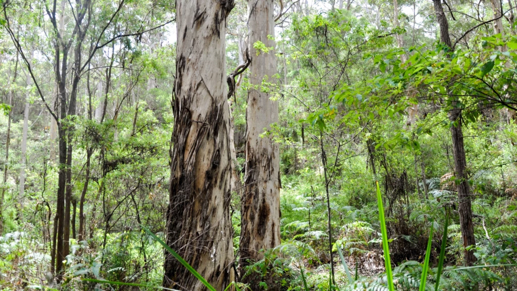
The two get confused, and the difference is rainfall and soil. Jarrah grows across the drier gravels of the Darling Plateau, on ground too poor in nutrients for most trees.
Karri belongs further south in the wettest corner of the state, where rain approaches 1,200 millimetres a year and karri reaches heights jarrah never does. Everything described below is plateau forest, cut through by one river valley that behaves differently from the country around it.
Four layers, one system
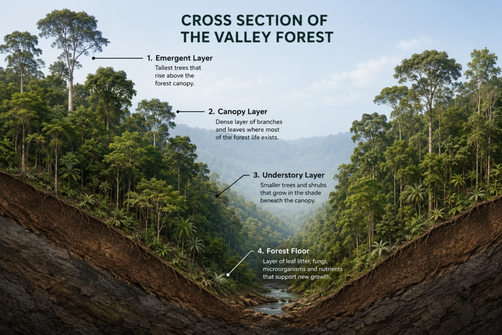
- Canopy. Jarrah and marri hold the top, spaced widely enough that light still reaches the ground.
- Mid storey. Banksia, sheoak and young eucalypts fill the band where the brush tailed phascogale hunts along branches at night.
- Understorey. Denser in the valley than on the plateau, because the cut of the river holds moisture the higher ground has lost by December.
- Soil and litter. Gravelly and low in nutrients. Jarrah grows here precisely because it tolerates ground that defeats most other trees.
That moisture difference is why the park’s species list is longer than its neighbours’. The park management plan describes the same thing: deep valleys, mature forest along the river and granite outcrops through it give animals that need damp cover somewhere to hold on while the plateau above dries out.
Ten threatened and priority species have been recorded here, and each one occupies a particular part of the structure.
What lives in each layer
| Layer | Species | What that layer gives it |
| Canopy | Carnaby’s black cockatoo | Feeding and roosting across marri |
| Canopy | Baudin’s black cockatoo | Seed from marri, a diet almost nothing else shares |
| Canopy | Forest red tailed black cockatoo | Jarrah and marri seed year round |
| Canopy | Peregrine falcon | Height to hunt from, granite outcrops to nest on |
| Canopy hollows | Western ringtail possum | Hollows that take a century or more to form |
| Mid storey | Brush tailed phascogale | Branch routes to hunt along, small hollows to nest in |
| Understorey | Quokka | Dense damp cover, which the valley holds and the plateau does not |
| Understorey and ground | Woylie | Digs for fungi, turning soil as it feeds |
| Ground | Chuditch | Open forest floor to hunt across at night |
| Ground and rock | Carpet python | Granite outcrops for warmth and shelter |
The mountain bike network through this park is called Wambenger Trails, after the Noongar name for the brush tailed phascogale that lives in the forest around Collie.
The water year
- Summer. Four dry months. Surface soil gives nothing, and the older trees hold on by reaching groundwater through roots driven deep into gravel and rock.
- Autumn. The first rains arrive late, later than they used to. Fungi appear in the litter within days of the ground wetting.
- Winter. Four fifths of the year’s rain falls between May and October. The Collie River runs hard and the understorey does its growing.
- Spring. Flowering through September and October, and the busiest weeks in the understorey.
That pattern is under strain. Rainfall across the Southwest has fallen 15 to 20% since the mid 1970s, and streamflow has dropped far more steeply than rain, because dry catchments absorb what lands on them before it reaches a river. Groundwater recharge across the region is now at its lowest level in 800 years.
If you are planning a visit around the flowering, [the best time of year to visit] sets out the seasons in detail.
Fire is part of the system, not an interruption
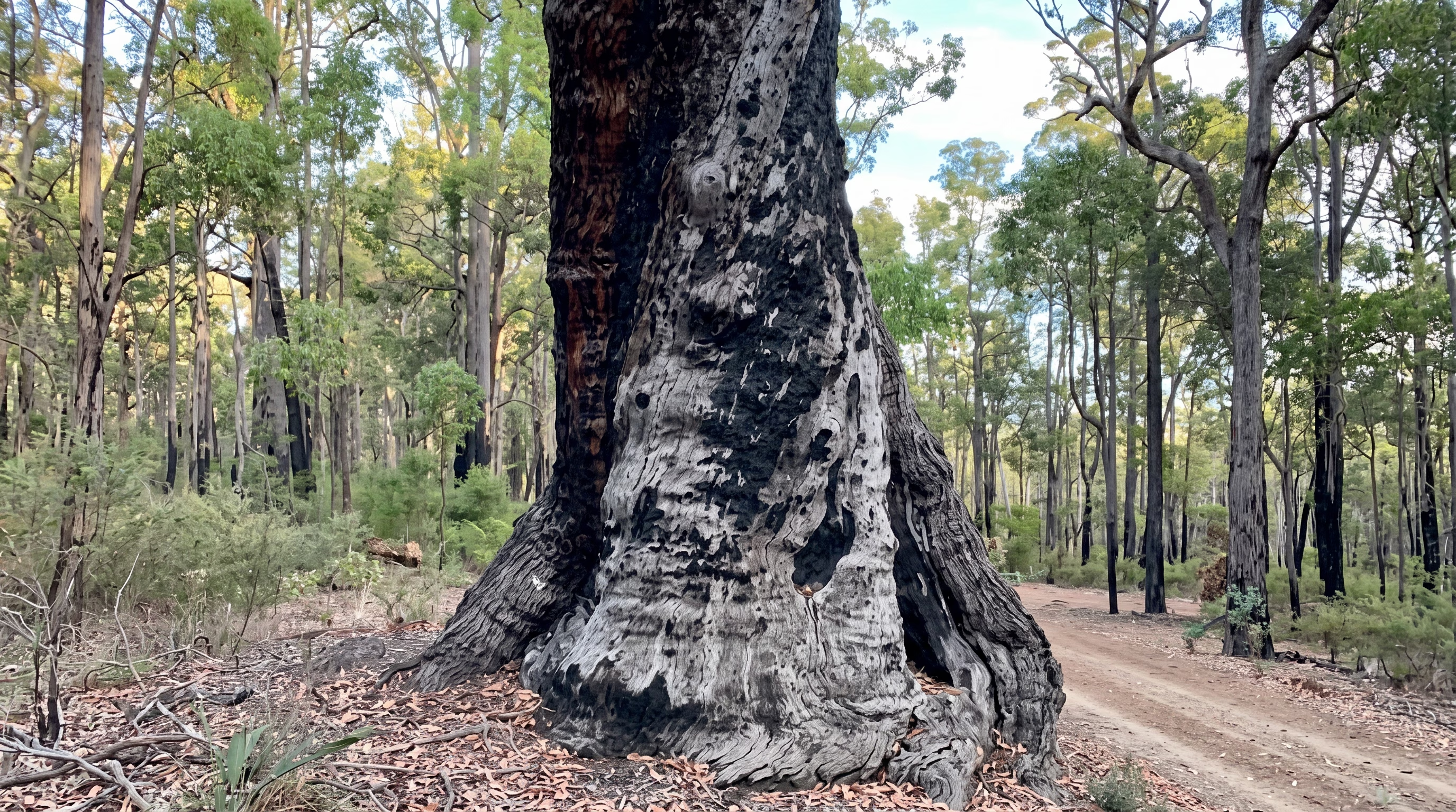
This forest evolved with fire and carries its recovery equipment with it. A burn clears the understorey and triggers growth that was waiting for exactly that.
- Lignotubers. A woody swelling at the base of the tree stores buds and energy, ready to shoot when the top is destroyed.
- Epicormic buds. Buds beneath thick bark push new leaves straight out of the trunk within weeks.
- Fire triggered seed. Woody fruits hold seed until heat opens them, releasing it onto cleared, ash fed ground.
Green shoots appear on burnt trunks within weeks. The understorey follows across the next few seasons, and the canopy takes far longer, which is why the oldest trees are the ones a fire cannot replace. A memorial tree lost to fire is replaced, and the ash placement stays in the soil where it was made. The full recovery sequence is set out in [how the Southwest forest regenerates after bushfire].
What puts the system under pressure
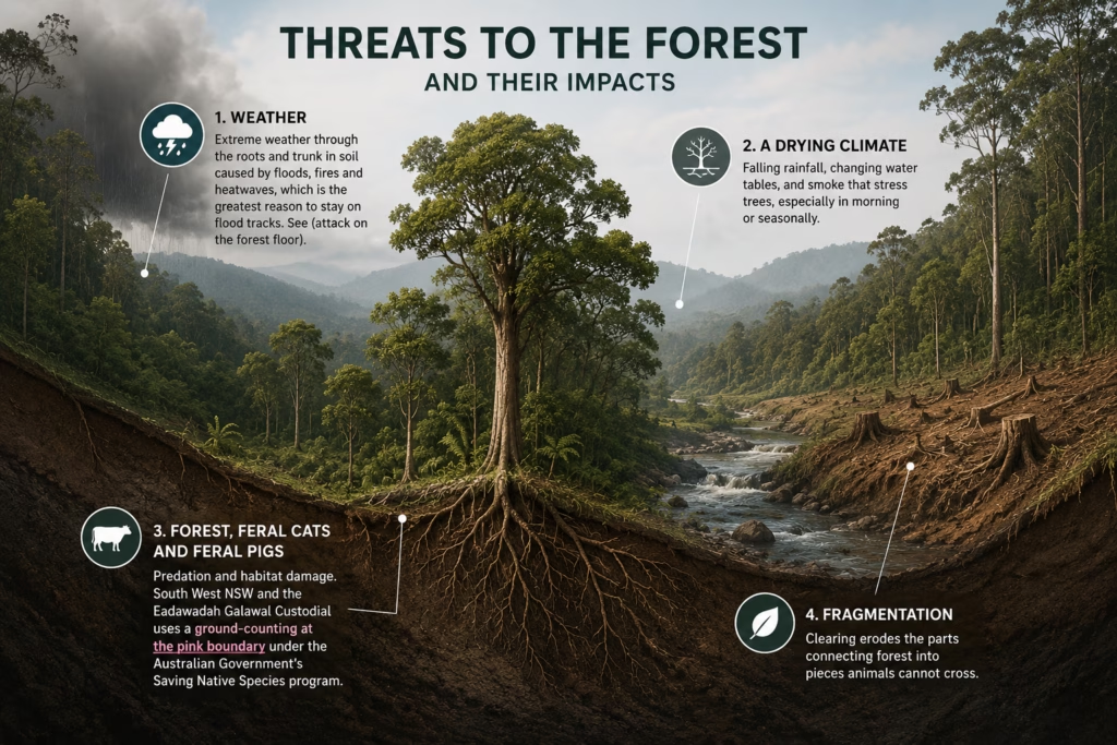
| Pressure | What it does here |
| Phytophthora dieback | Kills susceptible plants through the roots and travels in soil carried on boots, tyres and machinery, which is the practical reason to stay on formed tracks. See [dieback and the jarrah forest] |
| A drying climate | Falling rainfall, dropping water tables, and creeks that once ran year round now running seasonally |
| Foxes, feral cats and feral pigs | Predation and habitat damage. South West NRM and the Leschenault Catchment Council run a control program on the park boundary under the Australian Government’s Saving Native Species program |
| Fragmentation | Clearing outside the park cuts the remaining forest into pieces animals cannot cross |
The northern jarrah forest showed what drought can now do. After the dry of 2010 and 2011, stands collapsed outright where the weathered soil layer was too thin for roots to reach water.
What protects it
- A conservation covenant enforced by the Department of Biodiversity, Conservation and Attractions, which is a legal instrument rather than a policy a future government could reverse
- Native forest logging ended across Western Australia in 2024
- Native species only, grown for this soil and this rainfall
- Trees replaced at no cost if one dies
- Horticulturists caring for the plantings rather than a single planting day
- Feral predator control running on the park boundary
Walking and riding are welcome. Formed trails run through the park, including the Wambenger mountain bike network, with Bibbulmun Track and Munda Biddi crossings nearby. Every off track shortcut is a possible new dieback infection, which is why the tracks matter here more than in most forests.
Where the memorial forest sits inside the park
Living Legacy Forest occupies part of this valley at Wellington Dam. Families choose a native jarrah, marri, blackbutt or bullich, the same species that make up the forest around it, and treated cremated ashes are placed under the roots of that tree. The covenant means it cannot be logged or removed.
There are two packages, one for an individual and a shared option for two people, both one time payments with no ongoing fees. What each one includes is set out on the memorial tree packages page. Every ceremony also adds three understorey shrubs, planted as quokka habitat.
Wellington National Park has been logged, mined around, and dried out by half a century of falling rainfall, and it still holds ten threatened and priority species in a valley seven kilometres from a coal town. Families planting here are adding to that, one tree at a time.